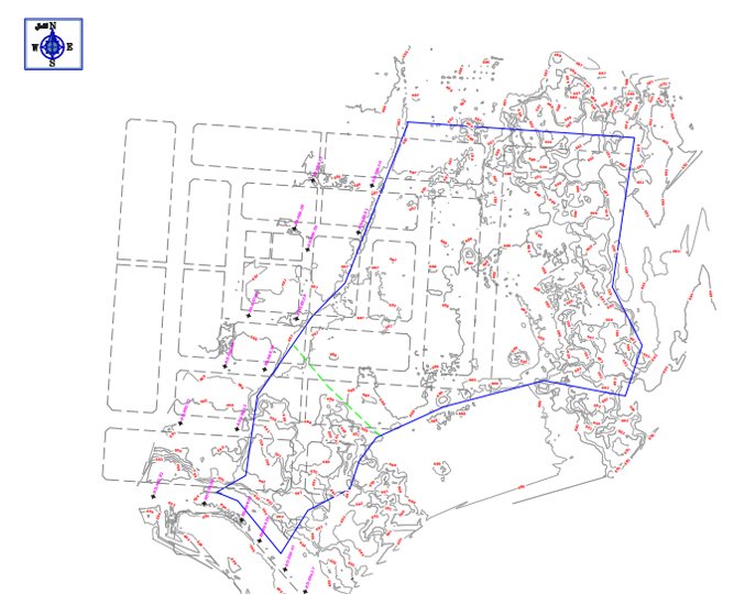
Our land development consultants provide the best land consultancy services in Saudi Arabia. We offer a variety of services to make your land development projects successful and efficient.

With 16 years of experience and strong connections with contractors, we’re really good at figuring out costs and spotting potential issues for new land development projects and we know kingdom regulations for environment.

Land acquisition

Our specialists team have extensive experience in acquiring land and rights for public and private developers. We undertake the acquisition of all types of properties and property rights.

Property consultancy

We provides property consultancy services to landowners that serves for sectioning and subdividing properties, building applications, applications for dispensations from the building law and appeals against decisions in building matters.

Cadastral surveys

We conducts cadastral services on behalf of municipalities and private individuals, documenting the boundaries of land ownership. We also produce the required documents and maps. Our services are always according to frame agreements municipalities.

Land Registry Compliant Plans

We offer land compliant plans as essential to establish legal ownership, facilitate property transactions, and ensure accurate documentation of land boundaries.

Deliverables

“Our drone survey services can provide a variety of deliverables depending on the specific needs and goals of the project”

Orthomosaic Maps

A detailed and geo-referenced map of the accurate ground surveyed area

Digital Elevation Models (DEM)

3D representations of the terrain, created by capturing elevation data during the survey

Digital Surface Models (DSM)

A DSM represents the surface of the Earth, including all natural and man-made features.

Contour Maps

It display lines connecting points of equal elevation, providing a visual representation

Thermal Imagery

They are created by collecting data on the location of individual points

Thermal Imagery

It is useful for applications such as building inspections, agriculture, road and railways

Volumetric Calculations

It calculate volumes of stockpiles, excavations, or other topographical features data

Interactive 3D Models

It allow users to explore and interact with the surveyed environment virtually

Get started with Khalid Al-Raddadi Surveys

Interested in finding out more about how our land surveying technology can assist you with your business needs?

Complete the contact form to find out more and get started.